
From 1 October 2026, the Marketplace of Italy’s national Earth Observation programme IRIDE is open, making its first geospatial services and products available to Public Administrations: from the environment to emergency management, and from water resources to security.
IRIDE enters its operational phase.
The Italian Space Agency (ASI) has announced the opening of the IRIDE Marketplace. From 1 October, the first 18 services, comprising 110 products, are available to Public Administrations to support activities across a wide range of areas, from environmental monitoring and emergency management to water resources and security.
Italy’s IRIDE Earth Observation programme, funded through the National Recovery and Resilience Plan (PNRR) and the Complementary National Plan (PNC), was built from scratch in just three years thanks to the collaboration of a large part of Italy’s space industrial and scientific ecosystem, coordinated by the Italian Government, ASI, and European Space Agency (ESA).
Planetek Italia's role in IRIDE
Planetek Italia has played an important role, contributing to the definition and development of several components of the IRIDE programme: from satellites to the Marketplace and services. Visit our dedicated page to find out more.
IRIDE SERVICES
The IRIDE Service Segment offers eight macro-services covering marine and coastal monitoring, air quality, ground motion monitoring, land cover, hydro-meteorological and climate monitoring, water resources, emergency management and security.
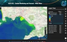
For coastal water quality, products cover the monitoring of chlorophyll, suspended solids and turbidity at different spatial and temporal resolutions.
Ground motion monitoring services make it possible to identify and track surface deformations associated with landslides, earthquakes and other natural phenomena. These capabilities are complemented by dedicated services for monitoring cultural heritage sites and critical infrastructure.
Other application areas include water resources, with services for monitoring drought, water availability and quality, and vegetation conditions, as well as urban areas, with services for monitoring urban heat islands and identifying the areas most exposed to this phenomenon. The portfolio also includes services covering air quality, greenhouse gases and a range of Essential Climate Variables, including land surface temperature, precipitation, snow, clouds, solar radiation, methane and carbon dioxide.
On-demand services will also include the mapping of areas affected by wildfires, enabling the identification of burnt areas and the resulting environmental changes.
For emergency management, IRIDE provides on-demand services for mapping floods, earthquakes, extreme weather events and tsunamis. These services can delineate affected areas, assess damage to buildings and infrastructure and, in the event of flooding, estimate water depth.
The services also include human settlement monitoring and Environmental Intelligence, with applications for identifying and monitoring potentially illegal waste accumulation and discharges into water bodies, supporting environmental monitoring and protection activities.
The product portfolio also includes a Digital Surface Model (DSM) and a Digital Terrain Model (DTM) at 1-metre resolution covering the whole of Italy.
Operational management of the IRIDE Service Segment is entrusted to Planetek Italia and e-GEOS, which coordinate their respective industrial consortia.
The 1 October release marks the beginning of a new phase for the IRIDE satellite programme. Further services and products will progressively become available, providing institutions with access to Earth Observation data to better understand, manage and protect Italy’s territory.
Would you like to learn more about IRIDE services?
Contact us at sales @ planetek.it (copy and paste without blank spaces)
Further information:
Timeline
- 2026
- 2025
- 2024
- 2023
- 2022
- 2021
- 2020
- 2019
- 2018
- 2017
- 2016
- 2015
- 2014
- 2013
- 2012
- 2011
- 2010