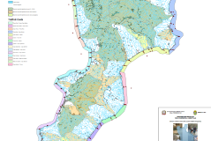
Water Protection Plans are fundamental knowledge tools, aimed at achieving the fixed quality goals in water bodies and, more generally, the protection of both the surface water and the groundwater systems. Water Protection Plans are by nature a dynamic tool with continuous updating and implementation of data, together with continuous updating due to the legislation updates.
The implementation of the information system for the management of monitoring data of the Water Protection Plan represents, consequently, a complex activity that must combine the dynamism of the reference legislation with the standardization of the processes and the software systems to be adopted.
Reuse consolidated processes already adopted in other administrations gives an excellent opportunity to reduce the time and risks associated with implementation.
ARPA Calabria has started this process, by acquiring in reuse from ARPA Puglia the OSA-GIS system and from the Sardinia Region the CEDOC system, which haev been integrated, updated and tailored to support the specific planning and management process established by the Regional Water Protection Plan (PTA).
The OSA-CEDOC system of ARPA Calabria allows monitoring data organization and validation, and makes available a unique knowledge base for the operational management of the PTA, as required by the WFD and national legislation.
At the operational level, the system features the planning and execution of field sampling activities and the organization of workflows.
The OSA-CEDOC system is a component of the global ARPA environmental information system that, in addition to data on waters, will also collect data of all the other environmental matrices such as soil, air, nature and biodiversity, as well as pressures and land registers.


