ULYSSES: Soil Sealing Assessment and Monitoring Project. A Mediterranean Regional Initiative by ESA.
Soil sealing – also called imperviousness – is defined as a change in the nature of the soil leading to its impermeability. Soil sealing has several impacts on the environment, especially in urban areas and local climate, influencing heat exchange and soil permeability; therefore, soil sealing monitoring is crucial especially for the Mediterranean coastal areas, where soil degradation combined with drought periods and fires contributes to desertification risk.
The project Mediterranean Soil Sealing, promoted by ESA European Space Agency, aims to provide specific products related to soil sealing presence and degree over the Mediterranean coastal areas by exploiting EO data with an innovative methodology capable to optimise and scale-up their use with other non-EO data. Such products have to be designed to allow – concerning current practices and existing services – a better characterisation, quantification and monitoring within time of soil sealing over the Mediterranean basin, supporting users and stakeholders involved in monitoring and preventing land degradation.
The project fits perfectly with the proposed EU Soil Monitoring Law which aims to protect and restore soils to ensure they are used sustainably. The law aims to address key soil threats in the EU, such as erosion, floods, landslides, sealing, as well as the loss of soil biodiversity.
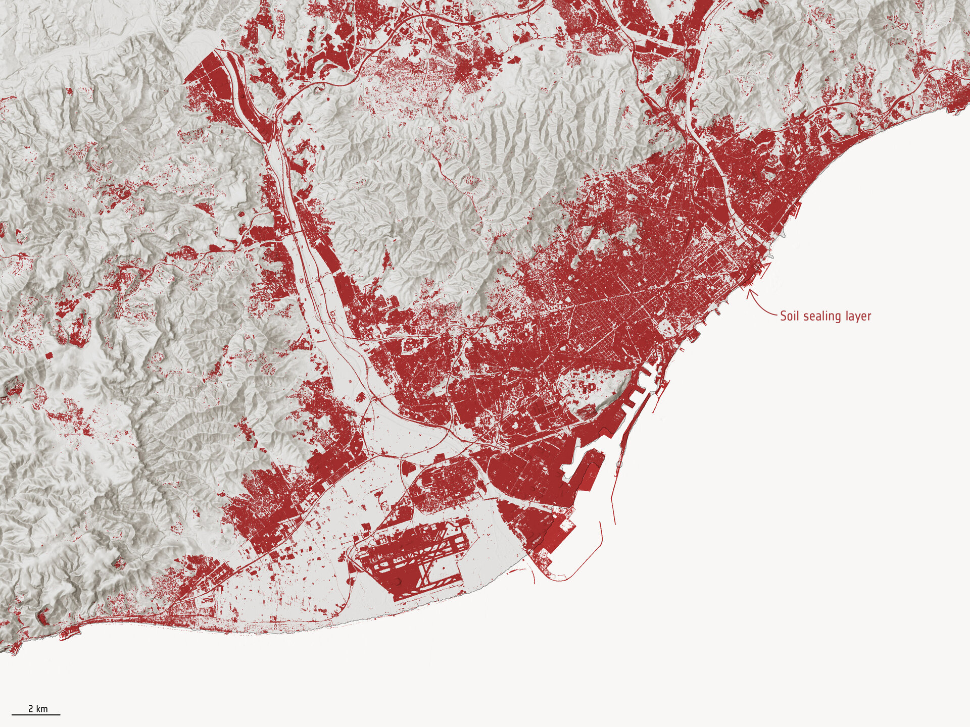
The targeted products generated from Copernicus Sentinel-2 are high-resolution maps of soil sealing over the Mediterranean coastal areas (within 20km from the coast) for the 2015-2020 time period, at yearly temporal resolution with a targeted spatial resolution of 10m. The team, led by Planetek Italia and supported by CLS and ISPRA, have generated maps spanning the 2018-2022 period. The maps have allowed for the quantification and monitoring of soil sealing over the Mediterranean basin, supporting users and stakeholders involved in monitoring and preventing land degradation.
In 2024, ESA decided to extend the scope of this mapping efforts from the coastal regions to encompass the entirety of the involved member states — specifically Spain, France, Italy and Greece.
The team
The industrial structure of the project is composed of two companies and one research centre, coming from Italy and France, grouped in a consortium for the scope and goals of the project. The project is led by Planetek Italia, and supported by CLS - Collecte Localisation Satellites (formerly SIRS, at the time of the proposal) and the Italian Institute for Environmental Protection and Research (ISPRA).
The interaction with the users is guided by ISPRA, which has a double role. ISPRA acts a “champion user”, being institutionally strongly involved in the land degradation theme into international and regional organisations and being the national body responsible for that theme in Italy where it also interacts with local authorities. Thanks to this deep involvement in all three User Groups, ISPRA is the best interlocutor for the other end-users especially for the ones belonging to the first two User Groups. For the sub-national level, it will be supported by Planetek Italia and CLS, which will exploit their relationships and links within organisations within the Mediterranean basin.
Ulysses Website
Learn more, download maps, explore the interactive geoportal with indicators: https://www.ulysses-project.org/

LEARN MORE
- The Ulysses project: https://www.ulysses-project.org/
- ESA article "From Space to Soil"


