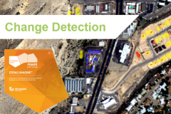
Webinar: Change Detection with Sentinel-2 data in ERDAS IMAGINE 2016
Friday 04 November 2016
The knowledge of the changes taking place on a territory is a fundamental process for urban and environmental planning. The webinar presents the different change detection algorithms available, from the simplest algorithms for image difference to the more powerful and versatile Zonal Change Detection, showing several practical examples and focusing, in particular, on the changes introduced by the 2016 release. The webinar will also demonstrate an example of use Sentinel-2 data.
During the webinar participants will receive all resources, Sentinel-2 demo data and tutorials, prepared in Italian language by Planetek Italia experts.
Webinar topics:
- Change Detection with ERDAS IMAGINE: algorithms availables;
- Change Detection with Sentinel-2A data: practical example;
- Analysis of outputs;
Description
 The knowledge of the territory in its dynamics is a key element to any sustainable territorial and environmental planning decision or restoration action.
The current wide availability of open satellite data (eg the Sentinel-2 data) allows professional users in the environment, urban planning, engineering and local government in the broadest sense, to have huge time series of free data, which capture and store, week by week, all the changes which take place on the territory. To analyze quickly and efficiently this large amount of data, the use professional tools that make it easier and faster the process of data interpretation is essential.
The analysis of "change detection" addresses this need, and is based on multi-temporal comparison of remotely sensed images, to identify the territorial changes occurred in a reference period.
The software ERDAS IMAGINE, powerful suite of Hexagon Geospatial software, provides professional tools to quickly and easily use satellite images management, and for change detection. ERDAS IMAGINE also allows users to maximize the information of satellite data, by simplifying the classification operation, orthorectification, mosaicking, reprojection, photo interpretation.
The webinar presents the different change detection algorithms available, from the simplest algorithms for image difference to the more powerful and versatile Zonal Change Detection, showing several practical examples and focusing, in particular, on the changes introduced by the 2016 release. The webinar will also demonstrate an example of use Sentinel-2 data.
The Zonal Change Detection tool, introduced with the latest versions of the software, provides users with a simplified interface and a guided workflow that allows you to easily identify changes that have occurred in the area, speeding up and making more rapid and automatic recognition of the work and change detection analysis even on large areas of land.
GeoXperience Webinars Agenda
Watch the agenda and subscribe to next webinars on https://www.planetek.it/geoxperience_webinar.
Note that, if you have missed some webinar, you can always replay it.

