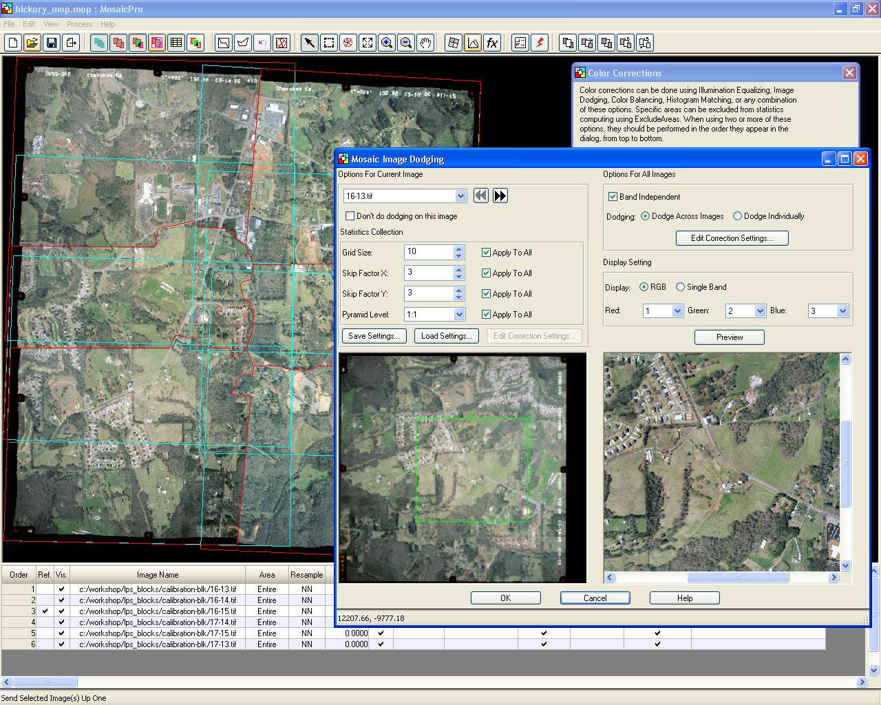
Imagine Photogrammetry (LPS) a seamlessly integrated collection of software tools, enables you to transform raw imagery into reliable data layers required for all digital mapping, raster processing, GIS raster analysis, and 3D visualization needs.
A fully functional photogrammetry system packaged in a user friendly environment, IMAGINE Photogrammetry provides results for everyone, from photogrammetry novices through advanced users.
IMAGINE Photogrammetry does not cut corners on either features or accuracy. State-of-the-art photogrammetry technology, such as full analytical triangulation, digital terrain model generation, orthophoto production, mosaicking, and 3D feature extraction, has been included in the easy-to-use environment. By automating precision measurement and including flexible operations such as terrain editing and feature extraction, IMAGINE Photogrammetry increases productivity while ensuring high accuracy.

IMAGINE Photogrammetry (LPS) maximizes efficiency without compromising quality and accuracy.
Designed specifically for ease of use, it frees users from the steep learning curve often associated with photogrammetric software.
The clean, intuitive interface makes it easy to learn and easy to use. The workflow-driven toolbar guides the process, giving you everything you need to execute a photogrammetric project from beginning to end. Data interoperability is never an issue with the extensive variety of input and output formats that are dynamically supported, including data from other leading photogrammetric software.
IMAGINE Photogrammetry helps you save time in other ways, too. A process-driven workflow that efficiently transforms imagery into reliable geospatial content is the key to increased productivity. From classic frame photography, large-format digital and pushbroom sensors, to a wide variety of satellite sensors, IMAGINE Photogrammetry supports numerous workflows.
These workflows may be tailored to fit various requirements to generate a variety of products.
Features such as automatic interior orientation, automatic tie point measurement, automatic terrain extraction, and intelligent multiple-port image loading let you focus on using your expertise to fine-tune the data by taking many of the repetitive tasks off your hands.

IMAGINE Photogrammetry
IMAGINE Photogrammetry is the most flexible photogrammetry solution on the market, handling a variety of workflows including:
- Triangulation and orthomosaic production
- Broad area mapping
- Transportation planning
- Engineering and facilities mapping
- Defense applications
- Close-range applications
Tight integration with ERDAS IMAGINE® means that this is the ideal photogrammetric package for projects involving varied types of data and further processing and analysis of airborne and satellite imagery. The added power of IMAGINE Advantage® is included with every IMAGINE Photogrammetry license, enabling you to go beyond the standard photogrammetric outputs and deliver value-added products to your customer.

