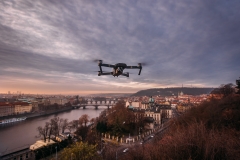
RPASInAir - Integrating UAS operating in a non-segregated airspace for services.
Nowadays the UAS is increasingly applied in civilian applications in the field of natural disaster management, assets monitoring and patrolling (coastal patrol, power lines, pipelines, and so forth), migration flows and crops observation.
Hence the need to enable an innovative service, which aims at land monitoring through the employment of data collected by RPAS that operate in a non-segregated airspace, such that mitigation and prevention procedures can be executed once a risk element is assessed. In order to safely include RPAS in a non-segregated airspace the development of an air traffic management system is needed.
The accomplishment of this objective goes through the definition of procedures, protocols and counter-measures aimed at managing new categories of critical events which are directly linked to the flight of remotely controlled aircrafts such as: loss of datalink between air platform and pilot station, loss of ATM-pilot station connection, loss of vehicle cognitive capacities.
It is fundamental to realize a Synthetic environment (SE) that can simulate the behavior of RPAS in order to design and experiment operations with new types of RPAS in complex scenarios with no risk.
Goals and outcomes
- Design and develop a laboratory for the simulation of air operation that allows to study, design, experiment and validate new rules, procedures and air traffic control standards and design, validate and plan air operations and missions with remotely piloted aircrafts.
- Development of advanced air traffic control (ATC) functionalities and applications for the integrated management of an air traffic composed by unmanned vehicles.
- Realization of a center that collects, manages and processes Earth observation data and integrates them with other data sources (satellites, …). This data center can process RPAS collected data in real-time or quasi-real-time and provide land-monitoring, risk prevention and emergency management services.
- Development of new sensors capable of detecting different sources of risk: hydrogeological risk, cryospheric risk and risk related to the presence of dust in the atmosphere (volcanic or coming from fires)
- Test and demonstration of the systems developed in the project (SE, ATM, applications, sensors) in laboratory and real environments with the executions of several RPAS missions aimed at showing the achievement of the expected performances.
Benefits
The development of skills, technologies and instruments capable of definitively open a new section in the aerospace global market, the one that offers land monitoring and control services provided by RPAS and satellites constellations. In order to fully understand how much these services are needed, one only needs to think about how climate change and human impact are intensifying the occurrence of dangerous phenomena like: extreme floods, landslides, avalanches and swells along the coast. In a country like Italy, and especially in southern regions, because of this, damages to people, properties and cultural heritage are getting increasingly severe. Precise monitoring of cryospheric ad hydrogeological phenomena together with risk assessment related to these events has a major role in all the phases that concern calamity management, from the identification of the threat to the emergency phase and civil protection intervention, from the evaluation of damage to its compensation. Hence one easily understands the absolute benefit coming from the development of aerospace technology in Apulia and in Italy.
Partners
Distretto Tecnologico Aerospaziale, ENAV, Telespazio, Università di Bari, Vitrociset, Aeroporti di Puglia, Università Kore di Enna, Istituto nazionale di fisica nucleare, Leonardo, Centro nazionale delle ricerche, ENEA, Planetek, Enginsoft, Politecnico di Bari.
Project cofunded by European Union – SIE, PON Ricerca e Innovazione 2014-2020 (www.ponricerca.gov.it)


